


Devil's footpath
The unique nature of the Sukulanrakka area can be explored more widely by touring the Devil's Footpath. The path was builded during 2009-2010 in cooperation with Lapland Vocational College.


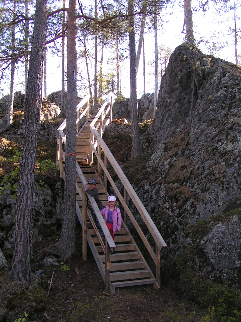
The Devil's Footpath is moderately difficult to navigate despite the stairs and bridges, so it is not suitable for all. The trail is also missing signs for the time being, but the trail formed in the terrain and the orange crepe strips make it easier to get around.
Show Devil's Footpath on the larger map
Nature spots of the Devil's Footpath are listed below. The destinations are also illustrated in the attached satellite map, where you can see the presentation by clicking on the blue signs.
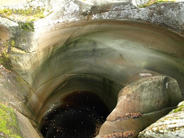 The devil´s churns |
 Smooth rock is a result of erosion by the powerful meltwater stream |
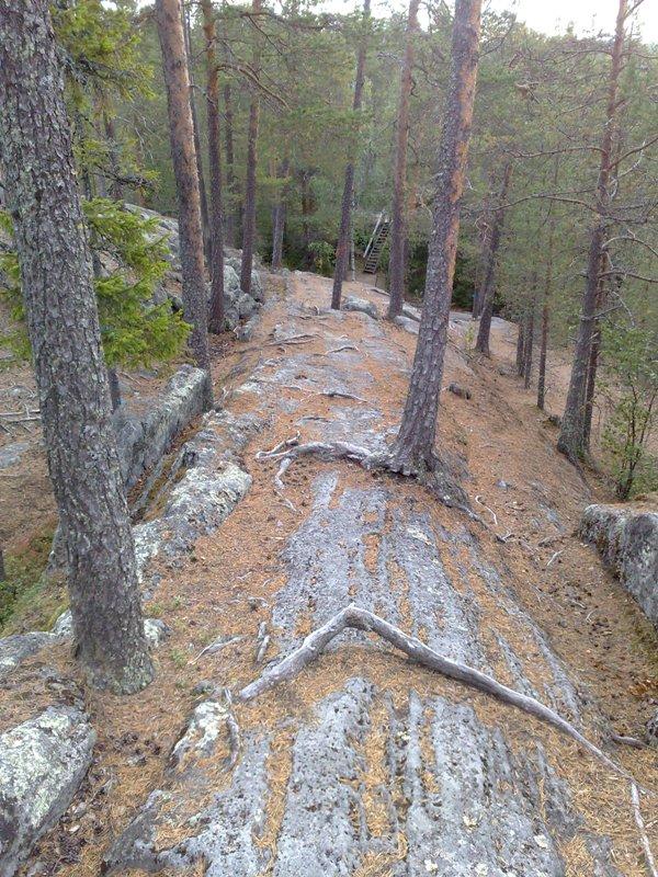
 Varied forest terrain and vegetation |
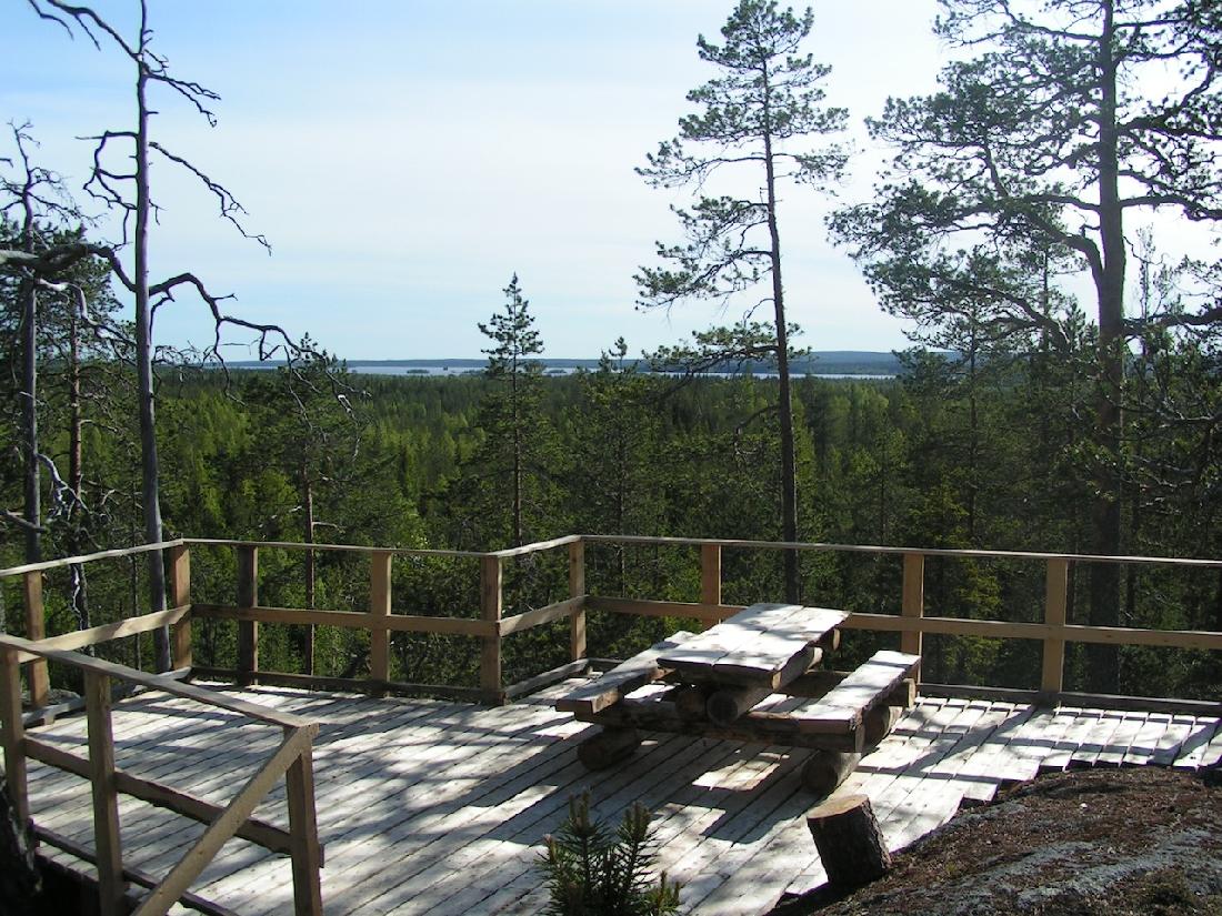 View from the observation deck to the Kemijoki valley |
 The cliff scarp and its immediate undergrowth |